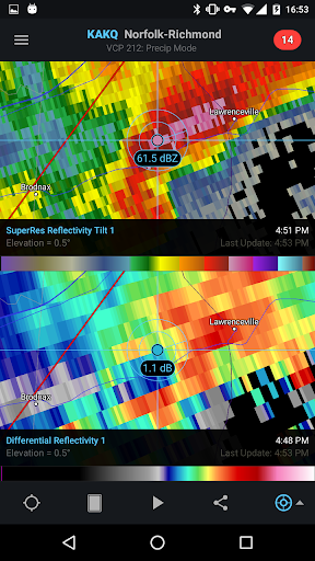
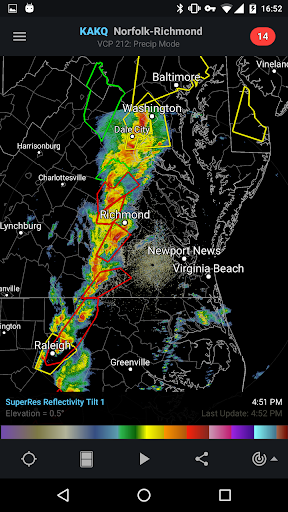
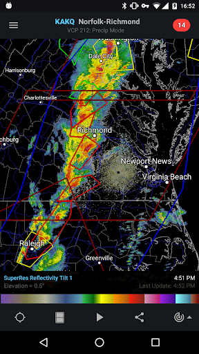
RadarScope is a professional weather radar display tool, especially for weather enthusiasts and meteorologists. It allows users to view Level 3 radar data of the new generation of weather radars, including the latest reflectivity, speed and other radar products, as well as severe weather alerts such as tornadoes, severe thunderstorms, flash floods and special marine warnings. RadarScope provides real Level 3 radar data, presented in its original radial format, ensuring that users get a high level of detail. In addition, RadarScope also displays tornado, severe thunderstorm and flash flood warnings issued by the National Weather Service, allowing users to keep abreast of dangerous weather information.
How to use RadarScope?
Select a radar site: Use the buttons on the map, the full radar list in the sidebar, or the favorites list saved in the menu bar to select the radar site you want to view.
Zoom in and out on the map: Use the mouse or pinch gestures on the multi-touch trackpad to zoom in and out on the map.
Scroll the map: Click and drag to scroll the map.
View warnings: Browse the list of active warnings in the information sidebar, select a warning to view details, and even zoom to the selected warning on the map.
View radar data: Click the play button to download up to 20 frames of radar data and create animations to better understand the development and movement of weather systems.
Export and Save: Copy the currently displayed map to the clipboard or save to a common image format.
Is RadarScope free?
RadarScope is not a completely free application. Although the specific charging method and price may vary by region and platform, in general, RadarScope provides paid and free versions. Paid versions generally provide more features and data, such as more radar site selection, longer radar archive, real-time hail profile data, and real-time lightning strike data. Free versions may contain ads and may provide more limited features and data.
RadarScope core features:
View radar data: including reflectivity, velocity, storm relative radial velocity and other products.
Severe Weather Alerts: Display tornado, severe thunderstorm and flash flood warnings issued by the National Weather Service.
Multi-platform support: Available on multiple platforms such as Mac, iOS, Android, etc.
Data Update: Automatically and intelligently retrieve and display updated data (approximately every 5 to 10 minutes).
Animation and Archive: Animate radar data and access an archive of radar images from the past 30 days.
Detailed Analysis: Provides features such as shear contours, hail contours, etc. to help users gain a deeper understanding of weather systems.
Comparison: Use the dual-pane feature to compare two radar products side by side.
Live Data: Includes live hail contour data and live lightning strike data (paid version only).